_t.jpg "Astrakiano- Kounaviano Gorge of Karteros")
_t.jpg "Ancient remnants at Karteros")
The Astrakiano gorge (or the gorge of Karteros) is part of a wider geological complex consisting the gorges "Kounavon-Astrakon-Karteros", approximately 21,500 km long.
This geological formation is located east of the city of Heraklion and runs through the Municipalities of N. Kazantzaki, Episkopi and Nea Alikarnassos. It is part of the wider area of the Yuhtas Ecological Park, in Archanes. The Yuhtas Ecological Park occupies a total area of 4,000 acres. The park includes Mount Yuhtas and three gorges: Knossano, Kounaviano and Astrakiano or Karteros Gorge which is the largest in length. The area is part of the Natura 2000 network points. In total, the gorges are connected in various points with the settlements that are located along their routes. There are five main entrances: one from Karteros, one from Aitania (bridge of Aitania), one from Ag. Paraskies (Kolomodi area), one of the Lower Astrakos and one in the Plain of Peza (entrance of Kounavianos gorge). Each entrance has an information booth. In the gorges of the park have been located places of historical and cultural value such as the ancient Eltina, the Minoan settlement of Myrtia and the Minoan cemetery of Astrakon. The gorges are a pocket of activities that combine the preservation and promotion of the natural beauty and the rich cultural heritage of the place. The rich waters of the area contributed to the creation of a system of watermills along the gorge. Today no one is working but the ruins of several are saved. The flora of the gorges includes hydrophilic species such as plane trees, willows and wicker as well as many endemics species of Greece or Crete. As for its fauna, it includes more than 44 species of birds and 7 species of mammals.
Brief description
The Astrakian gorge or the gorge of Karteros is one of the largest in the area, with a total route length of about 12.5 km. The starting point of the gorge is found after the settlement of Kato Astrakon. The river Karteros flows in its riverbed and along the route. The gorge ends in Mesa Karteros, in a specially designed area characterized by extraordinary beauty and leisure infrastructure. There is also a car park. We recommend leaving the car there to continue by foot to the beach of Karteros. The whole route lasts 3. 30 hours, characterized as an easy route. It is emphasized that in the gorge, works have been done that include basic infrastructure projects, in order to be able to visit safely. The forest tourism path, the installation of bridges, the wooden railing along the path and the signage facilitates and guide the visitor sufficiently. There were 10 watermills in the gorge before the war. The locals fished for eels and crabs in the waters.
Route to the Astrakian Gorge (or Karteros Gorge)
We reach Astrakos by bus via the Peza - Kasteli highway (bypass for Myrtia - Barbarians - Astrakos 18.5 km from Heraklion). Astrakoi is served by transport through Myrtia. In the village there are food shops and a cafe. At the eastern end of the settlement of Astraka and specifically from the central square begins a road that later becomes a trail road. This leads to the ruined settlement (abandoned in the early 1930s) of Kato Astrakon (2 km from Astrakon). From there we descend to the gorge by path (10 minutes’ walk).
On this road are the ruins of a basilica dedicated to St. George. It is a three-aisled Byzantine Basilica. At a distance of about 100 meters from it is the church of Panagia, with a unique representation of a Byzantine double-headed eagle above its door.
After the ruined church of Agios Georgios, there is an alternative route to the north, which leads to an olive grove, at the end of which begins a path with stone steps, which leads into the gorge, at the place "Neraidospilios".
The whole route will run through the gorge. The visitors will walk enjoying the landscaped stepped path on the road to the North. Inside the gorge of Karteros there are churches, watermills and an inn of the Byzantine period.
Going down we first see a stone-built water tank. At a distance of 3 minutes from the tank we meet the Fairy Cave.
This is a natural cave associated with legends about fairies and witches. Today the cave has been built and its entrance is closed with a gate (the cave is not open to the public). At the end of the cave gushing a water well that partially contributes to the water supply of the city of Heraklion. The landscape in the fairy cave with the small artificial lake, the abundant vegetation and the wild life is a place of special natural beauty that would be worth visiting.
In the gorge flows the Karteros river, on the banks of which you will wind up to the bridge of Aitania, in a path that passes several times over the closed aqueduct of the aqueduct. Formwork covers the closed aqueduct for reasons of protection where necessary. Small ponds, watermills, small waterfalls and sounds of nature (frogs, birds, rustling leaves) will accompany you for hours on your way.
In about an hour and 20 minutes (from Neraidospilio) you will have reached the open field of the "bridge of the Aitanians" which is characterized by cultivated areas and trail roads that converge towards the bridge. This bridge connects Scalani with Aitania.
Of particular interest are the last 20 minutes of hiking, during which you leave the gorges’ bed and move high, on the east wall of the gorge. The view both north and south is magnificent. Cross the bridge in a northerly direction and following the signage you will find the path that leads you once again to the gorge bed. Ten minutes later you will meet to the west, the branch of the route that leads to Kounavos, through the gorge of the same name.
Continuing north passing old watermills, aqueducts and small ponds, in one hour you will have reached the end of the route at the location "Mesa Karteros" where the information booth and the arranged area are located. Of particular interest shortly before the end of the route are the temples of ST. Nikolaos.
First, we meet the church of ST. Nikolaou. In this place there are buildings in ruins (watermills). A wooden door borders the gorge. Closing the door behind and following the wooden path, going to the river bed we meet a Byzantine inn with the characteristic arches on our left and after the recreation area of the entrance of Karteros. Here is the second church of ST. Nikolaos and a ruined settlement. The area has an information booth which is not yet operational. The visitor can be informed by the posted information sign - map of the gorge. In the place of the "Recreation Area of ST. Nikolaos" the route ends. With our car we can continue by road and through the settlement of Mesa Karteros to Nea Alikarnassos or to reach the beach of Karteros.
Walk on the coast of Karteros
The proposed route is a short tour of the Karteros plain. The route is smooth, lasts about one to two hours and starts 8 km east of the city of Heraklion. The route extends to the northern coastal zone of the municipality of Nea Alikarnassos which stretches along the coast with natural coves and ports.
Access to Karteros is by road following the old road network (National Road) Heraklion - ST. Nikolaos. The visitor that is located in the center of N. Alikarnassos follows the old national road in an easterly direction. The route ends at the archeological site of Amnissos.
At the beginning of the route, on the right and on the old national road, we meet the characteristic cave church of John the Baptist, with a second aisle dedicated to ST. Nikon the Metanoeite.
Kilometers of blond sand make an interesting wetland with the blue waters and the sea breeze of history and culture are the starting point of this route.
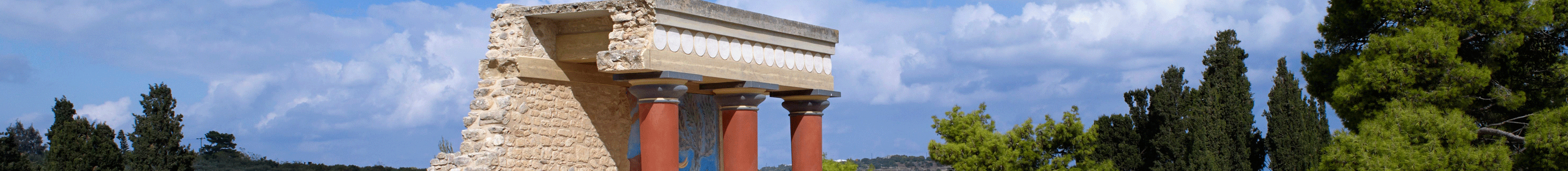
The area has been inhabited since early prehistoric times. The results of the excavations in the wider area of Karteros, brought to light settlements, architectural monuments, places of worship, burial complexes, port facilities and evidence of continuous habitation. The modern coastal settlement of Karteros is located on the Old National Road and gathers many tourist units.
At the Southwest end of the coastal settlement of Karteros, immediately after the airport, a secondary road leads us to Prassa and the settlement of Kalithea.
These settlements are characterized by dynamic development while at the same time they have a multitude of cultural elements that tell their own story.
The area of Karteros, is the most interesting area of the Municipality of Nea Alikarnassos in terms of natural environment. To the southeast of the area ends the "gorge of Karteros", which runs through three Municipalities (Episkopi, N. Kazantzaki and N. Alikarnassos) and is characterized by rich flora and important cultural and historical elements. In the area of Mesa Karteros there are places of archaeological and historical interest such as building complexes, watermills, etc.
The plain of Karteros is bordered and characterized by the river Karteros, which was one of the main communication routes of the palace of Knossos, both inland and sea, as near its estuary are located the main ports of Minoan Knossos. The estuary of the river and the small swampy area are located at the beginning of the route in the western part of the sandy beach of Amnissos. The Small estuary, the swampy areas and the sand zone attract many migratory birds.
The route continues along the famous beach of Karteros that attracts the interest of many visitors during the summer months. Karterou beach - ideal for sea sports such as windsurfing, because of its length and organization. Sunbeds, beach bars, cafes and taverns are widely available in the area.
The sea is wonderful, and the attentive entertainment infrastructure becomes a pole of attraction for the youth. At night, of course, the area is characterized by intense night entertainment, since the clubs and pubs of the area gather people from Heraklion.
Walking along the sandy beach on our right we meet the candidate preserved modern monument "Motel Xenia". The motel carries the signature of the internationally recognized architect Aris Konstantinidis, who was in charge of the construction of Xenia in the tourist destinations during the period 1950-1960, within the framework of a policy that had been adopted at that time for the tourist development. The building is drowned in flora and a romantic scent of another era. Unfortunately, it needs immediate rehabilitation.
The route is completed reaching the hill of Paliochora. The inhabitation of the hill (Amnisos) begins from the Middle Minoan period (19th century BC). The name is referred to as “a-mi-mi-so” on the Linear B Scripts. The visitor first sees the fenced area of the sanctuary of "Zeus Thenata", which was founded in the 7th century BC. (archaic era) and remained in use until the 2nd century AD. On the east side of the hill is the "Villa of the Lilies" which was destroyed by fire in the 15th Century BC. Complexes C and E continue to be inhabited until the 12th century BC. The hill was also inhabited during the Venetian occupation.
Near Amnisos on the eastern sides of the valley of the river Karteros, develops the sacred cave of Elythia, which unfortunately is not a visitable archaeological site. To the east, immediately after the plain of Karteros or Vathianos Plain and on the national road is the archeological sight of Nirou Hani. In this place was discovered a Minoan two-storey villa, consisting of about forty rooms with two corridors and courtyards. About 1 km west of Nirou Hani, in the place "ST. Theodoroi" were found the remains of a Minoan shrine and port.